Maps / Guides

Postcard by K. Tesik. Ceskoslovensky Orel, Brno 1939.

230,00 Kč

4 postcards, text in Russian.

970,00 Kč

Map. Illustrations and etchings by F. Borremans.

230,00 Kč

Deutsche Buch-Gemeinschaft, Berlin no date. Text in German. 36 maps - copperplates.

170,00 Kč

Artaria, Wien no date. Third edition. Lithographic maps.

730,00 Kč

Praha 1946. 138 maps and planes on 30 tables.

330,00 Kč

Travel links in Europe / Rail and automotive lines of the Czechoslovak Republic, without date.

730,00 Kč

Neubert, Praha 1948. 138 maps and plans.

330,00 Kč

Atlas Velkoněmecké říše 1939. Text in German.

530,00 Kč

Text in French. 12 postcards. No date.

130,00 Kč

Many illustrations. Svojtka a Co., Praha 2006.

330,00 Kč

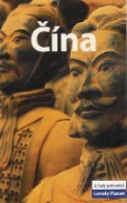
A Lonely Planet travel survival kit. Text in English. Many illustrations. Lonely Planet, Hawthorn 1997.

270,00 Kč

Rough guides, Jota, Brno 2007.

170,00 Kč

Jota, Brno 2010.

430,00 Kč

Rough guides, Jota, Brno 2002.

170,00 Kč

The Rough Guides. 1st edition. Jota, Brno 2003.

170,00 Kč

Rough guides, Jota, Brno 2004.

170,00 Kč

Rough guides, Jota, Brno 2005.

170,00 Kč

Rough guides, Jota, Brno 2004.

170,00 Kč

The Rough Guides. 2nd edition. Jota, Brno 2004.

170,00 Kč

Rough guides, Jota, Brno, 2002.

170,00 Kč

Many illustration. Pavel Korbr, Praha no date.

130,00 Kč

Melantrich, Praha 1951.

230,00 Kč

Rough guides, Jota, Brno 2007.

130,00 Kč

With map and illustrations. G. Sauerstein, Praha 1925.

130,00 Kč